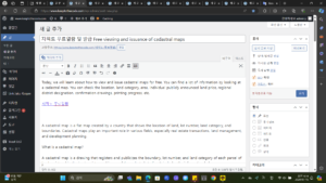
We will explain how to view all land registers and cadastral maps at once for free.
I also didn’t know that land documents could be downloaded in bulk, but I found out after a real estate agent told me about it.
Even though it is a government 24 service that can be used for free, many people do not know about it and share it.
Only cadastral maps are issued 
Only land ledgers are issued
Issuance of all land documents
index
Free viewing of land documents at once (all applications for land certification)
Free viewing of cadastral maps
1. Free viewing of government’s 24 cadastral maps
2. Free viewing of land connection cadastral maps
Free access to land register
Free viewing of land documents at once (all applications for land certification)
You can view the land register and cadastral map for free through the ‘Land Certification Bulk Application’. Batch application for land certification is a civil service service that allows you to receive all four types of land-related certificates (a copy of the land (forest) ledger, a copy of the cadastral map (forest map), a confirmation of individual publicly announced land price, and a confirmation of land use plan) at once.
Copy of land (forest) ledger
Copy of cadastral map (forest map)
Confirmation of individual publicly announced land price
Confirmation of land use plan
This service has been implemented since October 2020, but it is not yet widely known to the general public, so please take this opportunity to be aware of it.
 Government 24 Land Certification Bulk Application
If you would like to view the land register and cadastral map separately, please refer to the method explained in the next paragraph.
 Good article to read together: Checking the actual status of land transaction prices
Government 24 Land Certification Bulk Application
Free viewing of cadastral maps
Cadastral maps can be viewed free of charge by anyone, not just property owners. Two representative sites where you can view cadastral maps for free are Government 24 and Land Connection. We will guide you through how to view cadastral maps for free on each site.
1. Free viewing of government’s 24 cadastral maps
Free viewing of the Ministry of Land, Infrastructure and Transport’s cadastral map is available on the Government 24 website under the ‘Cadastral map (forest map) copy issuance (viewing)’ menu. You can obtain the certificate in person by visiting the city, county, district or town/myeong-dong administrative agency, but if you obtain it offline, a copy fee of 700 won and a viewing fee of 400 won will be charged. It is free when viewed through Internet electronic complaints.
Application for Government 24 issuance
Therefore, if you would like to view it for free, please be sure to apply at the Government 24 website below. Anyone can view it, even if they are not a member of Government 24.
Access the Government 24 website and click on the ‘Cadastral map (forest map) certificate issuance (view)’ menu.
Select ‘Issuance of a cadastral map copy’ and enter the address of the land location you wish to view.
Select ‘Online Issuance’ as the receipt method and click ‘Submit a complaint’.
Click ‘Print Document’ in ‘Service Application Details’ to view the cadastral map.
Government 24, a free cadastral map viewing site
Government 24 Land Certification Bulk Application Screen Selection Items
2. Free viewing of land connection cadastral maps
You can view cadastral maps for free by entering the relevant address on the Land Connection website. You can print the viewing screen, but you cannot print the cadastral map in document form like you can with Government 24. Since you can simply look it up on the website, it is recommended for those who want to lightly browse cadastral maps.
In the case of the above method, only the cadastral map of the viewed land is visible, but if you would like to also view the cadastral map of the surrounding land, it is recommended to use Land Connection’s map service.
Go to Land Connection
View land connection map
After accessing the Land Joint website, enter the location of the land you want to view in the address bar on the main screen.
Click the ‘View’ button on the right.
Click the ‘Print’ button on the right, select the desired item, and then click ‘Print’.
Save or print the contents of the cadastral map you have viewed as a PDF file.
Free viewing of land joint cadastral maps
Land connection cadastral map free viewing print screen
Free access to land register
Free access to the land register is only available to owners; non-owners must pay a fee. The land register can be viewed through the ‘Land (forest) register copy issuance (view)’ civil service service on the Government 24 site.
If you visit the city, county, district or town/myeong-dong administrative agency to receive the certificate in person, a copy fee of 500 won and a viewing fee of 300 won per lot will be charged.
Even when applying through the Internet electronic complaint, a copy fee of 300 won per lot (50 won per additional page) and a viewing fee of 200 won are charged. However, if the owner applies for online viewing and issuance, it is free without any fee.
Free viewing of Government 24 Land Register
After accessing the Land Joint website, enter the location of the land you want to view in the address bar on the main screen.
Click the ‘View’ button on the right.
Click the ‘Print’ button on the right, select the desired item, and then click ‘Print’.
Save or print the contents of the cadastral map you have viewed as a PDF file.